Satellite Imagery and Geospatial Solutions

Satellite Imagery and Geospatial Solutions

Sensing and Analysing Planet Earth

Fronted by ST Engineering Geo-Insights, a joint venture with DSO National Laboratories, our satellite imagery and geospatial analytics provide timely and relevant insights to empower you in decision-making, keeping your business ahead of the curve.

What We Do

Singapore’s NEqO Constellation

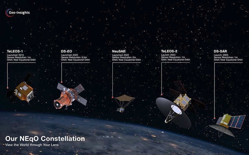
We are the exclusive distributor of satellite imagery for the Near Equatorial Orbit (NEqO) satellite constellation. This is the world’s first commercial constellation operating in NEqO that is capable of producing 50-centimetres resolution multispectral satellite imagery and quad-polarisation Synthetic Aperture Radar (SAR) imagery up to 1-meter resolution.

Revealing Business Insights from the Skies

Leveraging our in-house expertise in spectral, radar signal processing, computer vision and AI, we provide advanced geospatial analytics and information products.

Sales and Enquiries